Storm Prediction Center Mesoscale Discussion 269
[ad_1]
|
|
| Mesoscale Discussion 269 | |
|
|
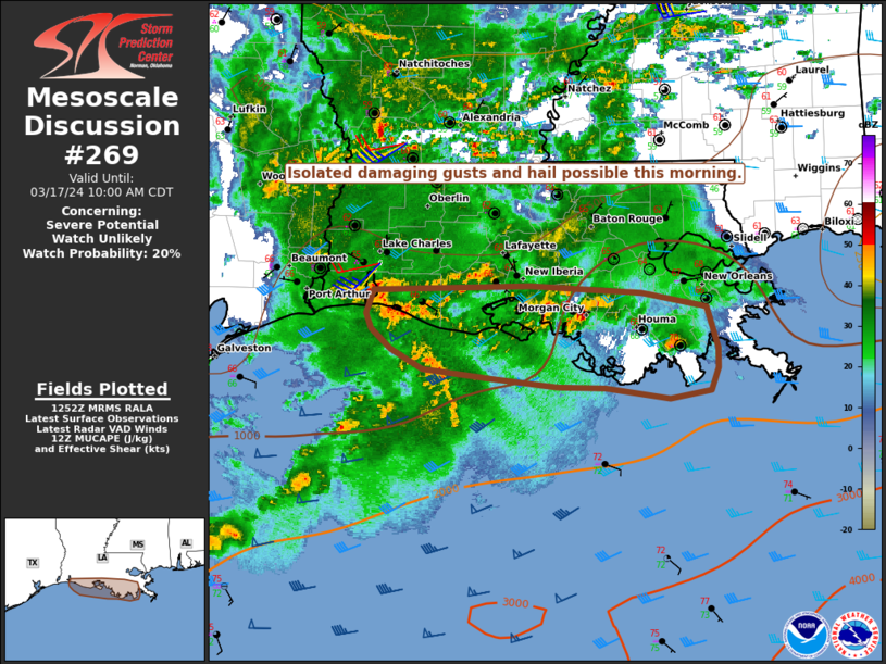
   Mesoscale Discussion 0269
   NWS Storm Prediction Center Norman OK
   0754 AM CDT Sun Mar 17 2024

   Areas affected...Parts of the LA Gulf Coast

   Concerning...Severe potential...Watch unlikely

   Valid 171254Z - 171500Z

   Probability of Watch Issuance...20 percent

   SUMMARY...Some threat for isolated damaging gusts and perhaps some
   hail may develop this morning.

   DISCUSSION...Widespread convection is ongoing this morning across
   the northeast Gulf of Mexico and adjacent portions of the LA and
   upper TX coasts, in association with a convectively enhanced
   shortwave trough. Continued upscale growth into an eastward-moving
   MCS is possible with time, as convection moves near/north of a
   baroclinic zone draped across the northern Gulf of Mexico. With the
   accompanying MCV expected to track near the coast, some threat for
   locally damaging gusts may evolve slightly inland if an organized
   MCS does develop. Otherwise, moderate elevated buoyancy could
   support an isolated hail threat within the warm-advection wing of
   the MCS across far southern LA.

   With the inland threat expected to remain generally limited in areal
   coverage and magnitude, watch issuance is currently considered
   unlikely.

   ..Dean/Thompson.. 03/17/2024

   ...Please see www.spc.noaa.gov for graphic product...

   ATTN...WFO...LIX...LCH...

   LAT...LON   29709333 29909326 29939174 29889066 29759003 29408991
               29238992 29048999 28989038 29069100 29079147 29159210
               29229279 29409309 29579328 29709333
|
|
|
Top/All Mesoscale Discussions/Forecast Products/Home |
|
[ad_2]