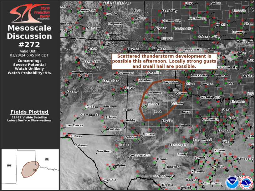
Storm Prediction Center Mesoscale Discussion 272
[ad_1]
|
|
| Mesoscale Discussion 272 | |

|
|
   Mesoscale Discussion 0272
   NWS Storm Prediction Center Norman OK
   0451 PM CDT Wed Mar 20 2024

   Areas affected...portions of the TX Panhandle and southwestern OK

   Concerning...Severe potential...Watch unlikely

   Valid 202151Z - 202345Z

   Probability of Watch Issuance...5 percent

   SUMMARY...Scattered thunderstorms are possible this afternoon across
   portions of the TX Panhandle and southwestern OK. Strong winds and
   small hail are possible with the strongest cores, although these
   hazards are expected to be relatively localized. A watch appears
   unlikely at this time.

   DISCUSSION...A few deeper updrafts are observed to the southwest of
   CDS in the TX Rolling Plains. They appear to be forced by broad
   near-surface convergence along a weak moisture gradient, with
   (relatively) higher dewpoints to the south (currently around 40 F).
   Mostly sunny conditions throughout the day have yielded well-mixed
   boundary layers throughout the region, with cloud bases estimated
   near 3 km AGL. Relatively cold temperatures aloft (around -16 to -18
   C at 500 mb per current RAP forecast profiles) yield some mid-level
   buoyancy that could support continued updraft development. The
   vertical wind profile is characterized by steadily strengthening
   westerly flow with height, yielding roughly 30-40 kts of mid-level
   shear in the estimated cloud-bearing layer. This could support some
   instances of small hail with any stronger updraft cores. Deep,
   well-mixed boundary layers would also support some risk of locally
   stronger winds associated with dry microbursts. The overall threat
   is expected to be rather localized and marginal, and watch issuance
   appears unlikely at this time.

   ..Flournoy/Edwards.. 03/20/2024

   ...Please see www.spc.noaa.gov for graphic product...

   ATTN...WFO...OUN...LUB...AMA...MAF...

   LAT...LON   33689995 33190050 32890127 32850190 33430224 34250197
               34800140 34980063 34979985 34769949 34199953 33689995
|
|
|
Top/All Mesoscale Discussions/Forecast Products/Home |
|
[ad_2]


