Storm Prediction Center Mesoscale Discussion 287
[ad_1]
|
|
| Mesoscale Discussion 287 | |

|
|
   Mesoscale Discussion 0287
   NWS Storm Prediction Center Norman OK
   0729 AM CDT Sat Mar 23 2024

   Areas affected...Parts of New England and east-central NY

   Concerning...Winter mixed precipitation

   Valid 231229Z - 231630Z

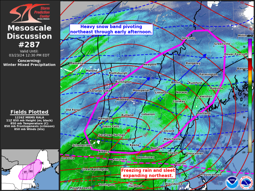
   SUMMARY...A mix of heavy snow, sleet, and freezing rain will
   gradually shift east-northeast from east-central New York across
   parts of New England into early afternoon. Snowfall rates of 1-2
   in/hr will persist within the heavy snow band, with
   liquid-equivalent rates of 0.05-0.15 in/hr common in mixed precip.

   DISCUSSION...A long-lived/well-developed swath of winter mixed
   precipitation is ongoing within a strong low-level warm theta-e
   advection regime across the Northeast. A band of heavy snow with
   rates likely near 2 in/hr is ongoing from roughly the Glens Falls,
   NY to Augusta, ME corridor per latest surface observations and radar
   imagery. This heavy snow band should pivot northeast in tandem with
   the shift in 850-mb frontogenesis through early afternoon. This will
   also yield a pivot from the ongoing west/east-orientation of the
   transition zone to sleet and freezing rain. As a result, southern
   portions of VT/NH/ME will transition to mixed precip by midday.
   Meanwhile, the heavy snow arc will shift more into northern parts of
   VT/NH to central ME.

   ..Grams.. 03/23/2024

   ...Please see www.spc.noaa.gov for graphic product...

   ATTN...WFO...CAR...GYX...BOX...BTV...ALY...

   LAT...LON   44027378 44377330 44987215 45297144 45517076 45737053
               45857031 45866979 45446915 44586925 43986966 43477055
               43157093 42997117 42757178 42687257 42707327 42767397
               43227425 44027378
|
|
|
Top/All Mesoscale Discussions/Forecast Products/Home |
|
[ad_2]


